Sarah
Grandstrand

Sarah
Grandstrand
A terrain map of a bike race through New Zealand
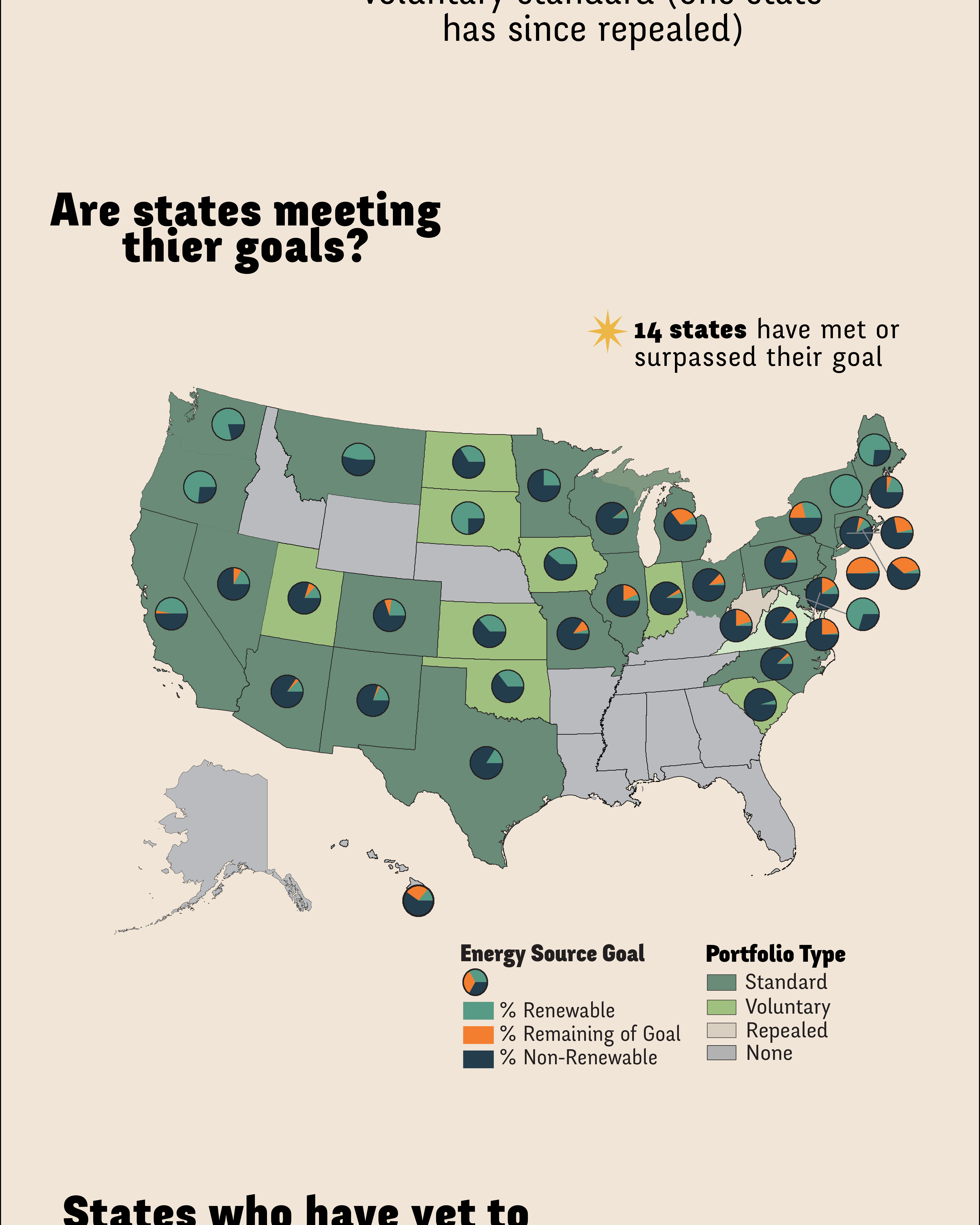
An informative look at the Renewable Portfolio Standards for each state
A mapbook of fiber internet network coverage
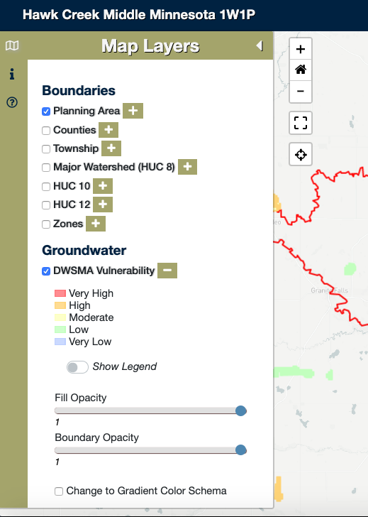
An interactive map designed as a tool to help the One Watershed One Plan Committee of the Hawk Creek Middle Minnesota Watershed planning area to determine management practices for the next 10 years.
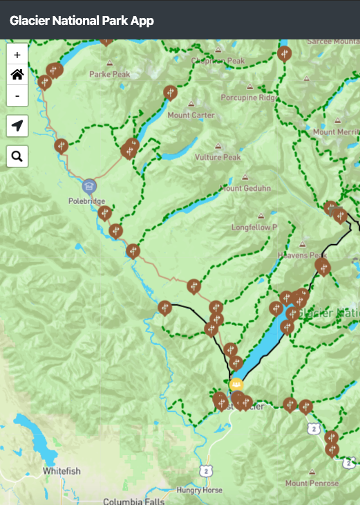
A responsive and interactive map designed for vistors to use before and during their visit to the park. Inlcudes a reporting feature for users to write reviews on trails.
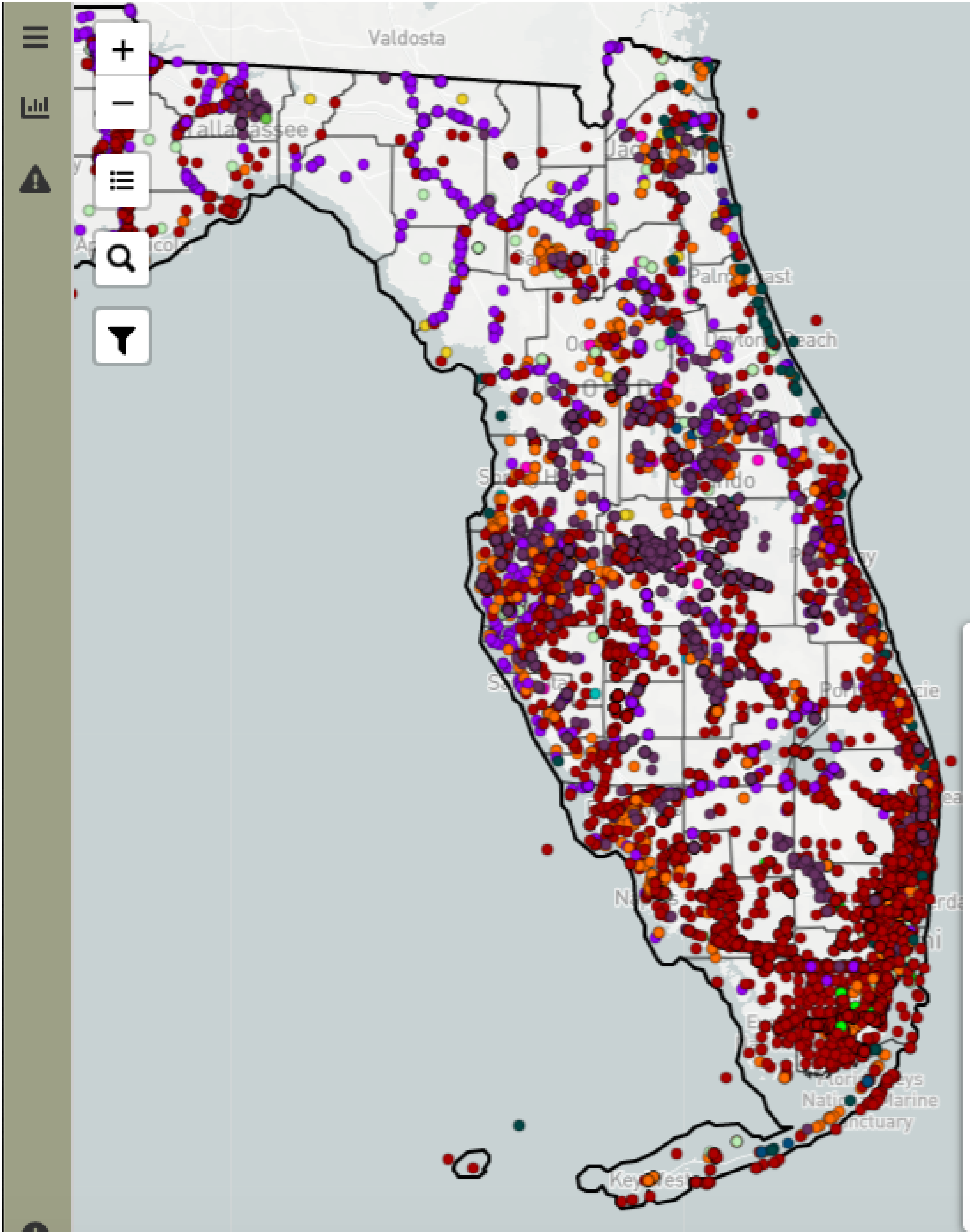
A responsive and interactive map showing the distribution of non-indigenous aquatic species in Florida.
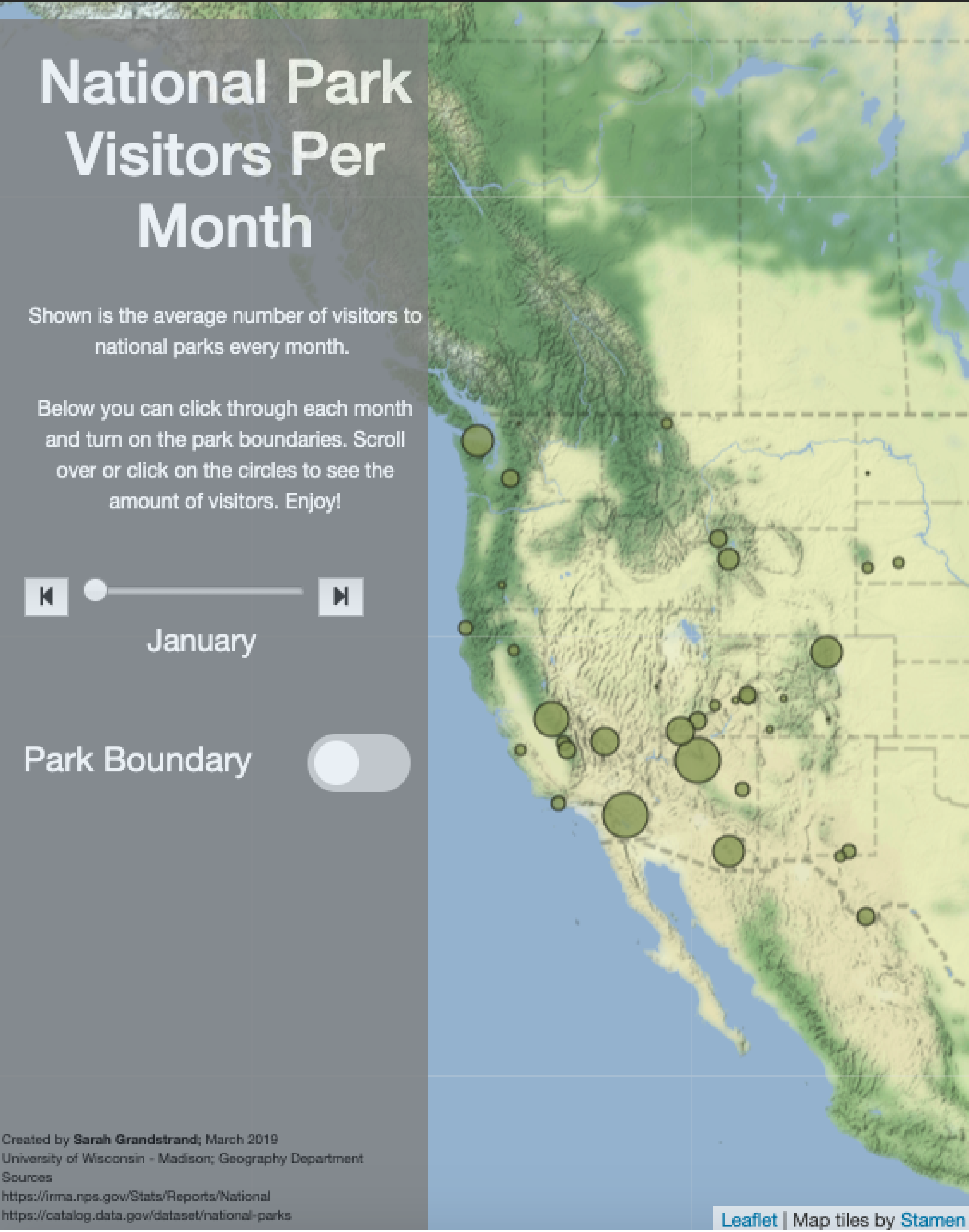
A proportional symbol map of the number of visitors to every state park per month using Leaflet and jQuery.
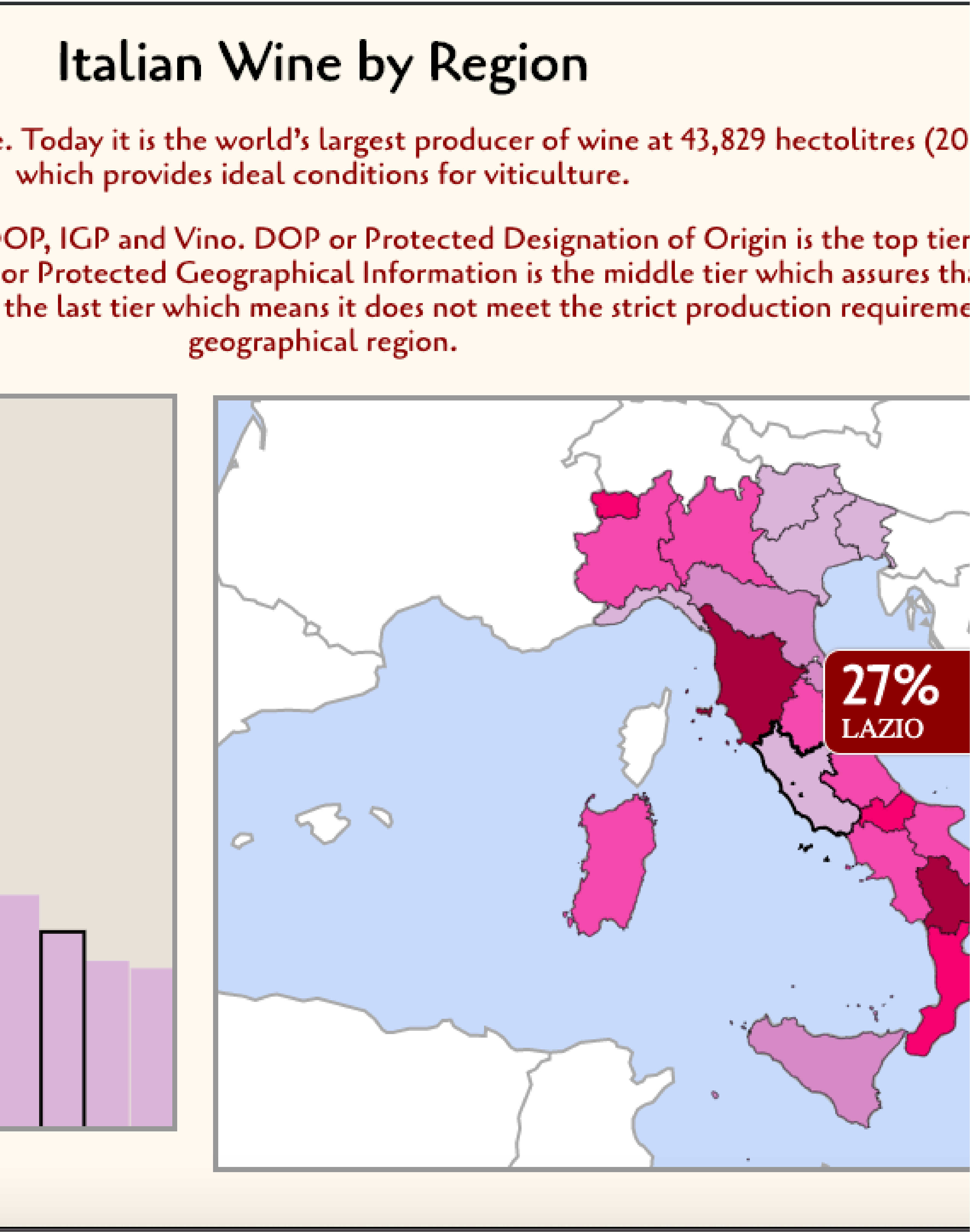
A responsive and interactive map and graph of wine distribution per region in Italy using D3.
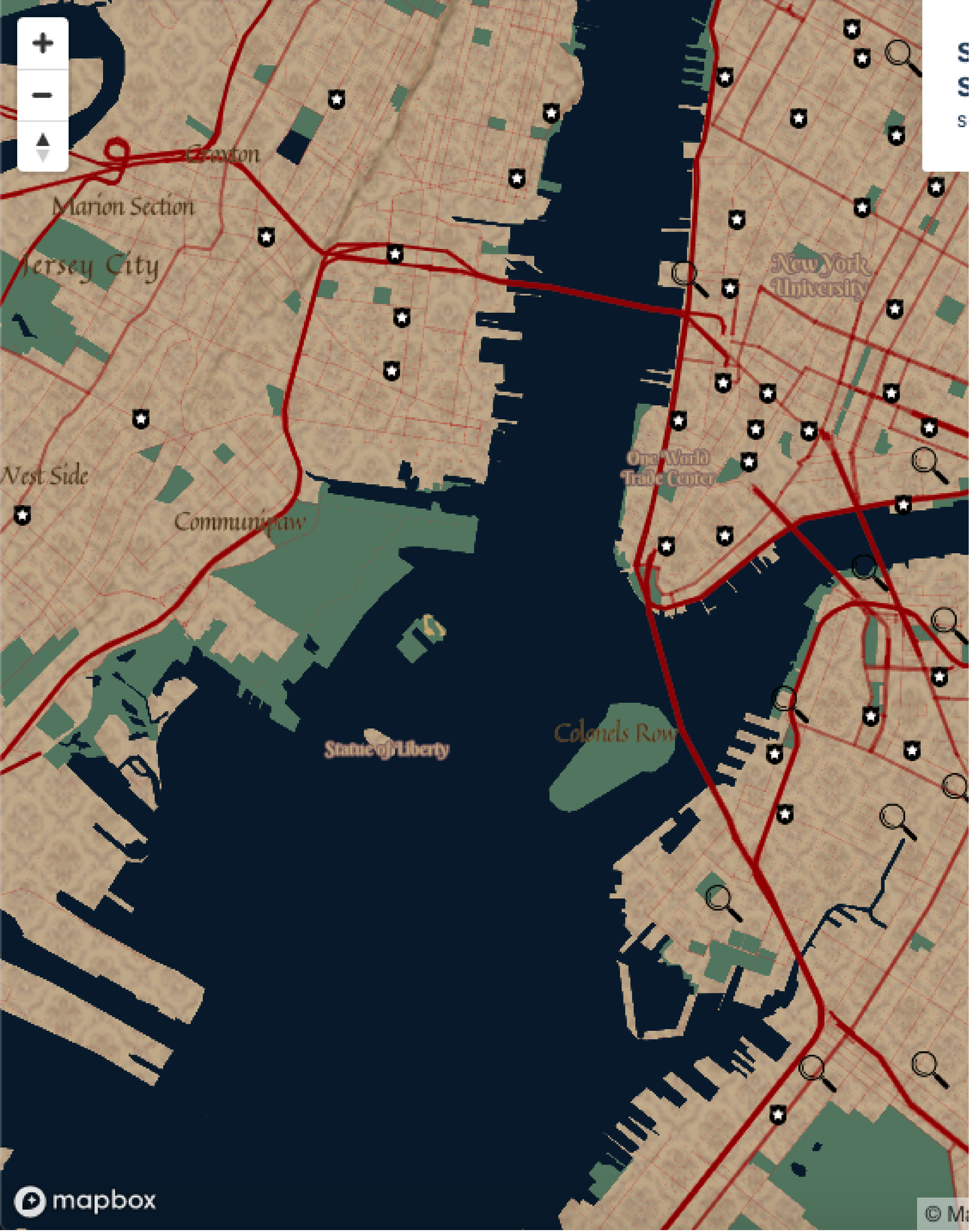
A map based on style themes from movies and TV shows of Sherlock Holmes using Mapbox. When you zoom in on U.S. cities badges represent police stations and each magnifying glass represents an unsolved homicide.
An analysis using GIS databases and ArcGIS products to model and determine ideal location of wind and solar farms across Oregon.
A poster and research paper on the environmental contaminent, Triclosan and its developmental toxicity on zebrafish larvae
A comparison of Landsat imagery to determine the extent of Urban Sprawl in Carver County, MN